An AI-native fork of QGIS with a built-in assistant: chat with your maps, run multi-step geospatial agents, and query your entire workspace — right inside the desktop.
Use Strata with a managed Strata Cloud account, or keep your own provider credentials in BYOK mode.
Strata is an independent, unofficial fork based on QGIS. It is not endorsed by or affiliated with QGIS.ORG or the QGIS project.
Strata is released under the GNU General Public License v2.0 or later (COPYING). It is an unofficial fork of QGIS — upstream source code: github.com/qgis/QGIS.




QGIS is a full-featured, user-friendly, free-and-open-source (FOSS) geographical information system (GIS) that runs on Unix platforms, Windows, and MacOS.
QGIS is part of the Open-Source Geospatial Foundation (OSGeo), offering a range of complementary open-source GIS software projects.
All packages are available from Releases.
| Platform | Download | What to do next |
|---|---|---|
| 🍎 macOS (Intel + Apple Silicon) | *.dmg |
Signed and notarized universal build. Double-click → drag Strata to Applications. |
| 🪟 Windows 10/11 (x64) | *-win64.exe, *-win64.zip |
Signed NSIS installer, plus portable ZIP with signed binaries. Verify the publisher before running. |
| 🐧 Linux (x86_64) | *.AppImage |
chmod +x Strata-*.AppImage then double-click. No installation required. |
⚠️ Linux AppImage builds are currently not signed. Windows builds are Authenticode-signed, but SmartScreen reputation may still warm up for new releases.
chmod +x Strata-*.AppImage
./Strata-*.AppImage
Works on Ubuntu 22.04+, Fedora 38+, Debian 12+, Arch, and any distro with glibc >= 2.35 and FUSE installed.
Full interactive demo also on the landing page.

Ask in plain language: the assistant inspects active layers and CRS, runs PyQGIS code (run_python), and updates the map — e.g. building an external mask from a municipality boundary.

For multi-step work, switch to Plan: Strata outlines layers, fields, and symbology to create, then waits for Accept plan or Reject / revise before changing the project.
Strata Cloud is the recommended setup when you want managed AI models, credit accounting, and account-level model preferences without handling provider API keys.
You can create and use a Strata Cloud account in two ways:
- From the web app: register at app.getstrata.org/registrati, then sign in at app.getstrata.org.
- From Strata Desktop: open AI Assistant → ⚙ settings → Account, choose Sign up or Log in, and enter email + password.
Current account policy:
- Registration and login use email/password. Passwords must be at least 8 characters.
- If an email is already registered, use Log in instead of creating a second account.
- After a successful desktop login, Strata exchanges the web access token for a desktop session token and selects the managed Strata Cloud / Plan Account provider.
- The web account area shows credit balance, usage history, and credit purchase options.
- Signing out from Strata Desktop removes the local desktop session token.
Credential and data policy:
- Strata Cloud desktop tokens are stored through Strata's local secret store. When the QGIS authentication vault is unlocked or configured, secrets are encrypted there; otherwise Strata warns that credentials are stored unencrypted in local settings.
- Cloud context sync is opt-in. Strata only uploads explicitly approved safe context, and blocks geometry, coordinates, WKT, and datasource URI payloads before upload.
- BYOK remains available for OpenAI, OpenRouter, Anthropic, Codex/ChatGPT, and Claude OAuth if you prefer to use your own provider credentials.
- Open Strata.
- Menu View → Panels → AI Assistant.
- Click the ⚙ settings icon in the top-right corner of the panel.
- In Account, log in or create a Strata Cloud account for managed models and credits.
- If you prefer BYOK, configure a provider under the provider settings instead: OpenAI/OpenRouter/Anthropic API key, Codex/ChatGPT login, or Claude OAuth.
- Close the dialog and try sending a message in the chat.
Provider credential options:
- OpenAI: platform.openai.com/api-keys
- OpenRouter: openrouter.ai/keys
- Anthropic: console.anthropic.com/settings/keys
- Codex/ChatGPT: in the settings dialog, choose “Get Codex device code”, open the page shown, and complete sign-in. The Codex model uses
gpt-5.5. - Claude OAuth: in the settings dialog, choose “Login with Claude” and paste the authorization code when prompted.
BYOK keys are stored locally on your machine. OAuth logins save refresh tokens locally through the same secret-store path used by Strata Cloud desktop tokens. Credentials are never sent to any server other than the provider or Strata Cloud endpoint you choose.
For desktop launches, always use one of the existing mode scripts rather than starting the binary directly:
# Starts and verifies the local strata-be service, then opens the SSD build.
./scripts/run-strata-dev.sh

# Opens the same desktop build against Cloud Run only. It never starts a local backend.
./scripts/run-strata-prod.sh
run-strata-dev.sh uses http://localhost:3001, starts ../strata-be when necessary, and waits for /health/ready. run-strata-prod.sh uses https://strata-be-372580174147.europe-west1.run.app/ai/messages. The scripts deliberately ignore an inherited STRATA_PLAN_ENDPOINT; set STRATA_BACKEND_LOCAL or STRATA_BACKEND_PROD only when deliberately targeting another environment. STRATA_PLAN_TOKEN remains available for supplying a desktop token during development.
The desktop app always defaults to production Strata Cloud:
https://strata-be-372580174147.europe-west1.run.app/ai/messages
Localhost is used only when you launch via run-strata-dev.sh (which sets STRATA_PLAN_ENDPOINT). Stale localhost or example.invalid values saved in local settings are automatically reset to production on the next launch.
| Symptom | Likely cause | Fix |
|---|---|---|
| Connection refused | Backend endpoint points to localhost:3001 but no local strata-be is running |
Use run-strata-dev.sh, or set Advanced → Backend endpoint to the production URL above |
| Connection refused (release app) | Leftover dev endpoint in local settings | Restart Strata (auto-reset) or set the production URL in Advanced |
| Incorrect email or password | Wrong credentials | Use Log in if the email is already registered |
| HTTP 402 | Out of credits | Top up credits in the web account area |
Product direction and release planning for Strata: strata_cursor_roadmap.md.
Covers phased delivery (assistant MVP → Context Engine → GIS Tab → Agent v2 → workflows → vertical packs → enterprise), backlog priorities, and metrics. Cursor agents are configured to consult this document automatically.
QGIS upstream documentation (Features, community, docs…)
- Support for raster, vector, mesh, and point cloud data in a range of industry-standard formats
- Raster formats include: GeoPackage, GeoTIFF, GRASS, ArcInfo binary and ASCII grids, ERDAS Imagine SDTS, WMS, WCS, PostgreSQL/PostGIS, and other GDAL supported formats.
- Vector formats include: GeoPackage, ESRI shapefiles, GRASS, SpatiaLite, PostgreSQL/PostGIS, MSSQL, Oracle, WFS, Vector Tiles and other OGR supported formats.
- Mesh formats include: NetCDF, GRIB, 2DM, and other MDAL supported formats.
- Point-cloud format: LAS/LAZ and EPT datasets.
- Data abstraction framework, with local files, spatial databases (PostGIS, SpatiaLite, SQL Server, Oracle, SAP HANA), and web services (WMS, WCS, WFS, ArcGIS REST) all accessed through a unified data model and browser interface, and as flexible layers in user-created projects
- Spatial data creation via visual and numerical digitizing and editing, as well as georeferencing of raster and vector data
- On-the-fly reprojection between coordinate reference systems (CRS)
- Nominatim (OpenStreetMap) geocoder access
- Temporal support
Example: Temporal animation

Example: 3D map view
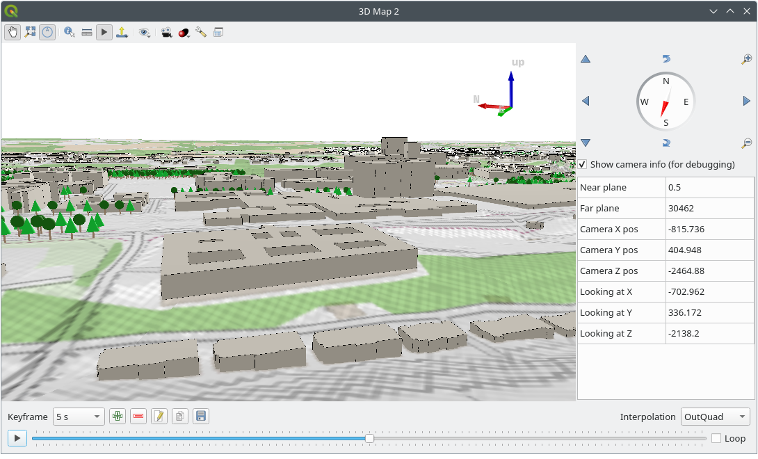
- Large variety of rendering options in 2D and 3D
- Fine control over symbology, labeling, legends and additional graphical elements for beautifully rendered maps
- Respect for embedded styling in many spatial data sources (e.g. KML and TAB files, Mapbox-GL styled vector tiles)
- In particular, near-complete replication (and significant extension) of symbology options that are available in proprietary software by ESRI
- Advanced styling using data-defined overrides, blending modes, and draw effects
- 500+ built-in color ramps (cpt-city, ColorBrewer, etc.)
- Create and update maps with specified scale, extent, style, and decorations via saved layouts
- Generate multiple maps (and reports) automatically using QGIS Atlas and QGIS Reports
- Display and export elevation profile plots with flexible symbology
- Flexible output direct to printer, or as image (raster), PDF, or SVG for further customization
- On-the-fly rendering enhancements using geometry generators (e.g. create and style new geometries from existing features)
- Preview modes for inclusive map making (e.g. monochrome, color blindness)

For more maps created with QGIS, visit the following pages:


- Powerful processing framework with 200+ native processing algorithms
- Access to 1000+ processing algorithms via providers such as GDAL, SAGA, GRASS, OrfeoToolbox, as well as custom models and processing scripts
- Geospatial database engine (filters, joins, relations, forms, etc.), as close to datasource- and format-independent as possible
- Immediate visualization of geospatial query and geoprocessing results
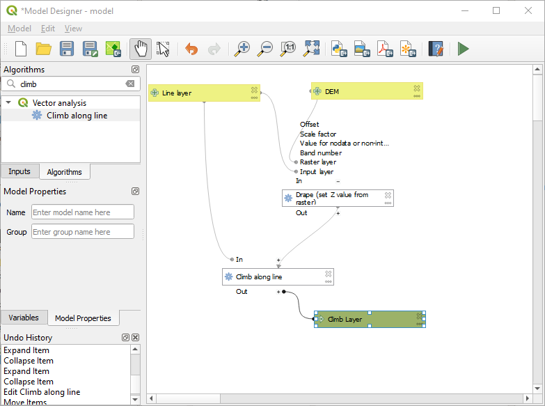
- Model designer and batch processing
Example: Travel isochrones

Example: Model designer
- Fully customizable user experience, including user interface and application settings that cater to power-users and beginners alike
- Rich expression engine for maximum flexibility in visualization and processing
- Broad and varied plugin ecosystem that includes data connectors, digitizing aids, advanced analysis and charting tools, in-the-field data capture, conversion of ESRI style files, etc.
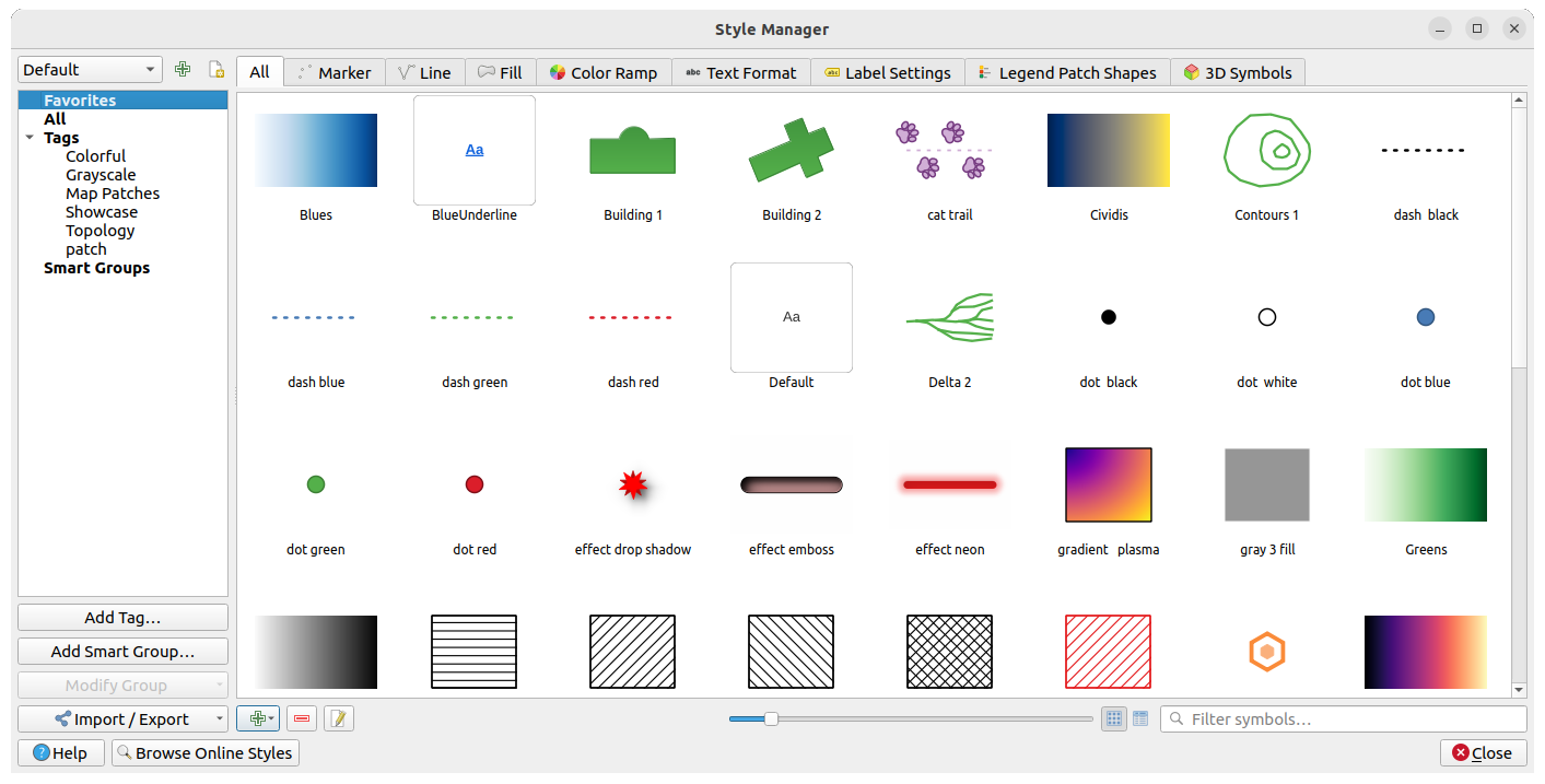
- Style manager for creating, storing, and managing styles
- QGIS style hub for easy sharing of styles
- Python and C++ API for standalone (headless) applications as well as in-application comprehensive scripting (PyQGIS)
Example: Style manager
Example: Plugins

Headless map server -- running on Linux, macOS, Windows, or in a docker container -- that shares the same code base as QGIS.
- Industry-standard protocols (WMS, WFS, WFS3/OGC API for Features and WCS) allow plug-n-play with any software stack
- Works with any web server (Apache, nginx, etc) or standalone
- All beautiful QGIS cartography is supported with best-in-class support for printing
- Fully customizable with Python scripting support
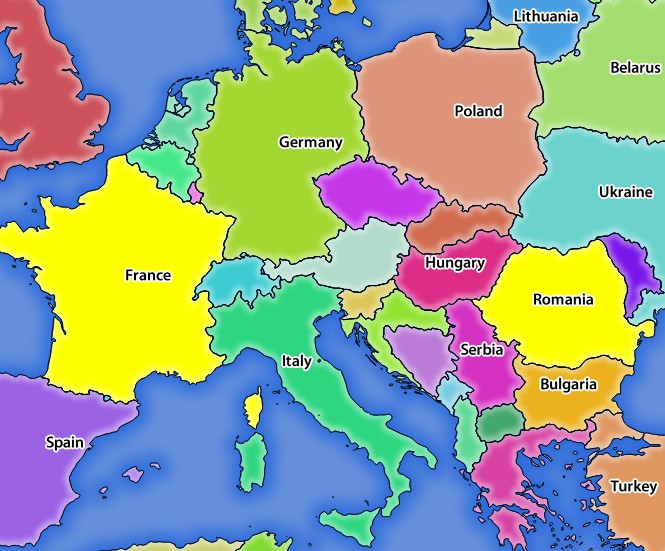
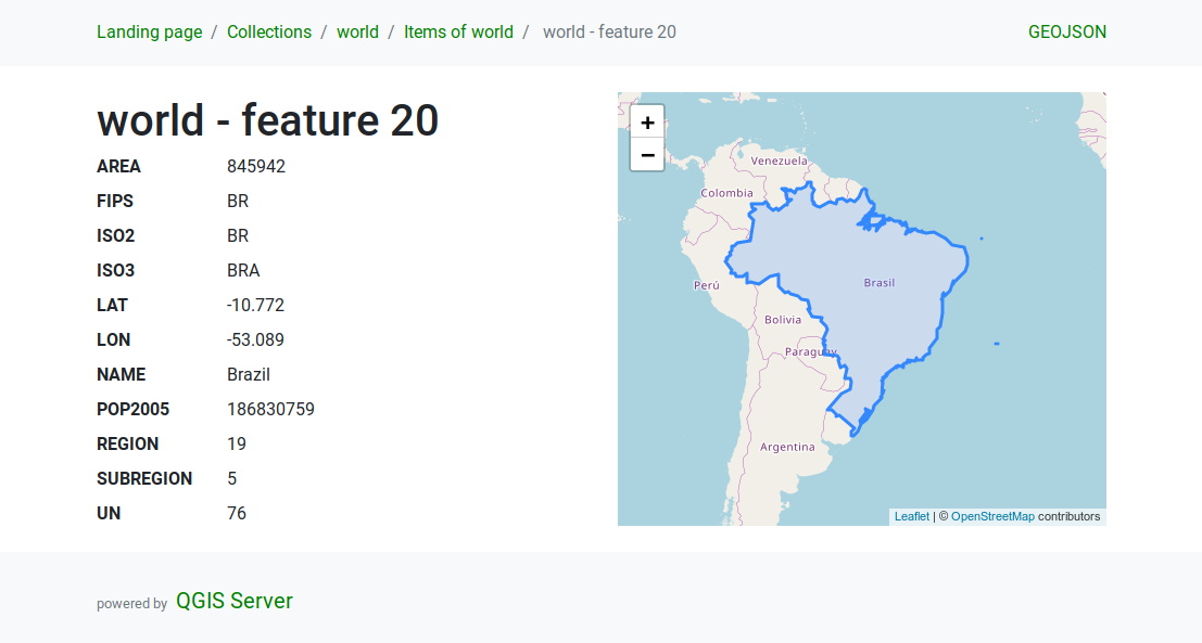
Example: QGIS server WMS response
Example: QGIS server WFS response
QGIS is developed using the Qt toolkit and C++, since 2002, and has a pleasing, easy to use graphical user interface with multilingual support. It is maintained by an active developer team and supported by vibrant community of GIS professionals and enthusiasts as well as geospatial data publishers and end-users.
QGIS development and releases follow a time based schedule/roadmap. There are three main branches of QGIS that users can install. These are the Long Term Release (LTR) branch, the Latest Release (LR) branch, and the Development (Nightly) branch.
Every month, there is a Point Release that provides bug-fixes to the LTR and LR.
QGIS is released under the GNU Public License (GPL) Version 2 or any later version. Developing QGIS under this license means that you can (if you want to) inspect and modify the source code and guarantees that you, our happy user will always have access to a GIS program that is free of cost and can be freely modified.
QGIS is part of the Open-Source Geospatial Foundation (OSGeo), offering a range of complementary open-source GIS software projects.
Precompiled binaries for QGIS are available at the QGIS.org download page. Please follow the installation instructions carefully.
The building guide can be used to get started with building QGIS from source.
For installation of QGIS Server, see its getting started documentation.
A range of documentation is available. This includes:
- Training Manual
- QGIS User Guide
- QGIS Server Guide
- Visual Changelog
- Documentation Guidelines
- QGIS Python (PyQGIS) Cookbook
- QGIS Python (PyQGIS) API
- QGIS C++ API
- Developers Guide
There are several channels where you can find help and support for QGIS:
- Using the QGIS community site
- Joining the qgis-users mailing list
- Chatting with other users real-time. Please wait around for a response to your question as many folks on the channel are doing other things and it may take a while for them to notice your question. The following paths all take you to the same chat room:
- Using an IRC client and joining the #qgis channel on irc.libera.chat.
- Using a Matrix client and joining the #qgis:osgeo.org room.
- At the GIS stackexchange or r/QGIS reddit, which are not maintained by the QGIS team, but where the QGIS and broader GIS community provides lots of advice
- Other support channels